Best World Map and United States Wall Maps for Education and Décor
Finding the right wall map that combines global perspective with a clear focus on the United States can boost learning, travel planning, and classroom or home decor. The following selections emphasize durable lamination, readability for kids and students, and high-contrast labeling. Each option supports visual learning with bold colors, clear borders, and practical features like two-sided maps or laminated surfaces for dry-erase use. This guide compares five top picks to help you choose a map set that fits your space and educational goals.
| Product | Brand | Type | |
|---|---|---|---|
| Laminated World Map & US Map Poster Set – 18″ x 29″ | Palace Learning | 2-in-1 Laminated Poster | 3 MIL lamination; USA and world maps; Made in USA |
| World Map Poster & Map of the United States For Kids – 2pc Set | Momo & Nashi | Kids 2-piece Set | Bright artwork; up-to-date details; ideal for preschool |
| US and World Desk Map (13″ x 18″) | Lighthouse Geographics | Desk Map, Two-Sided | U.S. states with inserts; world map on back; clear labeling |
| 24×36 World and USA Classic Premier 3D Two Wall Map Set | Swiftmaps | Two Wall Maps | 3D terrain relief; laminated; large format |
| 2 Pack – Laminated World Map & US Map Poster Set – Yellow | Palace Learning | 2-in-1 Laminated Poster | 18″ x 29″; heavy-duty lamination; tear resistant |
Laminated World Map & US Map Poster Set

The Palace Learning Laminated World Map & US Map Poster Set combines global and national geography in a single space-saving format. Each poster measures 18 by 29 inches, giving ample detail without overwhelming a classroom wall. The posters are laminated with a sturdy 3 mil film, providing durability and easy cleaning for busy learning environments. This two-in-one design helps students connect continental layouts with American geography, reinforcing spatial awareness and basic geography vocabulary through visual reference and labeling.
World Map Poster & US Map For Kids – 2pc Set

This two-piece set from Momo & Nashi targets early geography learning with kid-friendly visuals. The World Map and United States Map posters use bright colors and approachable icons designed to capture toddlers and early learners’ attention, helping kids recognize continents, major countries, and U.S. states. The posters are ideal for preschool classrooms, homeschool spaces, or a child’s bedroom wall. The design emphasizes clarity and readability to support memory and recognition, making it a practical foundation for geography play and early literacy in a home or school setting.
US And World Desk Map (13″ x 18″)
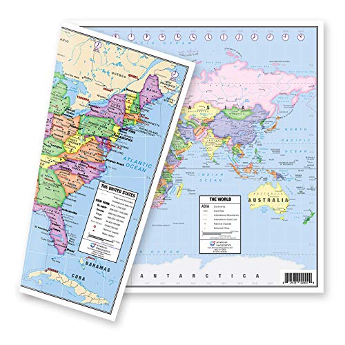
The Lighthouse Geographics desk map provides a compact, two-sided solution suitable for desks, small classrooms, or tutoring spaces. One side presents a political United States map with time zones, state capitals, and clear delineations of the fifty states (with Hawaii and Alaska inserts). The reverse side features a world map with current labeling and a zoomed Europe inset for detailed study. This format supports quick reference during lessons, student activities, and travel planning discussions in a compact footprint.
24×36 World And USA Classic Premier 3D Two Wall Map Set

Swiftmaps offers a large, dual-wall map experience with 24×36 inch laminated posters featuring world and U.S. maps. The 3D terrain relief provides a tactile sense of elevation, helping learners visualize physical geography alongside political boundaries. Laminated surfaces ensure durability in classrooms or busy family spaces, while the bold coloring and legible fonts support quick reference during lessons or geography-themed games. This option suits larger walls and spaces where a strong focal geographic feature is desired.
2 Pack – Laminated World Map & US Map Poster Set – Yellow

The Yellow edition from Palace Learning mirrors the 18×29 layout with two laminated posters. The heavy-duty lamination adds tear resistance and durability for high-traffic spaces or homeschooling areas. Its bold color contrast and clear typography are designed to improve readability from a distance, helping students quickly locate continents, oceans, and U.S. states during group activities or daily geography routines. This version serves as a practical alternative for color-coordinated decor in classroom or kids’ rooms.
National Geographic Road Atlas 2026

While primarily a road atlas, National Geographic’s Road Atlas 2026 includes detailed USA, Canada, and Mexico coverage suitable for planning trips and understanding regional geography in a broader context. Its reference scale and reliable cartography make it a complementary resource for learners who want a travel-oriented view of geography beyond wall maps. This option is best for students and families who combine wall maps with travel planning and adventure learning.
World Map And USA Map For Kids – 2 Poster Set

This Palace Learning two-poster set emphasizes high-quality lamination (3 mil), tear resistance, and easy readability for children. The design focuses on practical learning with a clear font and straightforward geography labeling, making it suitable for homeschooling rooms, playrooms, or classrooms where a distraction-free learning environment is desired. The posters support early geography literacy through visually engaging maps that are also durable enough for active kid spaces.
Buying Guide: Key Purchase Considerations
- Format and size: Choose posters or desk maps based on wall space and viewing distance. Larger formats like 24×36 provide strong focal points, while 13×18 desk maps fit smaller areas or reference surfaces.
- Durability: Laminated surfaces protect against spills and fingerprints. A 3-mil or thicker laminate offers greater tear resistance in busy environments.
- Audience and readability: For kids and beginners, bright colors, simple labeling, and large font improve retention. For older students, include more detail such as time zones and political boundaries.
- Two-sided options: Desk maps with both U.S. and world views maximize versatility for quick reference and comparative learning.
- Educational features: Look for inset maps (like Europe or states and capitals) and up-to-date political boundaries to ensure relevance and accuracy.
- Compatibility with decor: Color schemes that complement a classroom or child’s room help create an engaging learning environment.
- Durability vs. cost: Laminated options tend to be more durable and reusable with dry-erase markers, but consider space, usage, and maintenance when selecting.
- Supplementary resources: Consider pairing wall maps with atlases, globes, or online geography tools to reinforce spatial thinking and cross-reference.
- Ease of installation: Check for mounting options like pre-punched holes or frames if you plan to rotate maps frequently or adjust layouts over time.
- Educational goals: Clarify whether the priority is global awareness, U.S. geography literacy, or a combination, and choose accordingly.