Best Paper Maps for Navigation: Clear, Durable, and Easy-to-Use Options
Discover top paper maps that still serve as reliable navigation tools for road trips, camping, or classroom use. This guide highlights five well-regarded options, emphasizing readability, detail, durability, and up-to-date information. Each entry includes a direct link to its Amazon page and a visual preview to help you compare at a glance.
| Product | Brand | Format | Key Benefit |
|---|---|---|---|
| Rand McNally Easy to Read: Colorado State Map | Rand McNally | Flat/Colorful State Map | Clear city detail with mileage and driving-time data |
| National Geographic Road Atlas 2026: Adventure Edition | National Geographic | Comprehensive U.S./Canada/Mexico atlas | Trusted national-scale road network and updated routes |
| United States Interstate Highway Map – Full Color | Ahlrsyy | Folded road map | Interstate networks and city indices for quick planning |
| Rand McNally Classic Edition U.S. Wall Map | Rand McNally | Large wall map | Topographical cues and up-to-date U.S. coverage |
| NOWMAP AquaShield Double-Sided United States Map Poster | NOWMAP | Double-sided poster | Waterproof, durable, and customizable with pins |
Rand McNally Easy To Read: Colorado State Map

The Rand McNally Colorado state map emphasizes readability with clearly labeled interstates, U.S. and state highways, and county routes. It includes detailed city maps and a mileage chart, plus a Mileages & Driving Times Map for quick trip planning. Regular updates ensure alignment with current road networks and scenic byways. The full-color design aids color-coding of regions and zones, reducing guesswork when navigating unfamiliar terrain.
National Geographic Road Atlas 2026: Adventure Edition

National Geographic’s Road Atlas Adventure Edition combines comprehensive road coverage with detailed national and regional maps. It serves as a dependable reference for trip planning across the United States, Canada, and Mexico, featuring reliable cartography and clear labeling. The atlas supports navigators who prefer a traditional paper backup to digital devices, with durable pages and legible fonts. Ideal for road trips, hiking access routes, and exploring off-the-beaten-path destinations.
United States Interstate Highway Map – Full Color Road Map
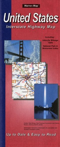
This folded map highlights the United States interstate network with full color schemes for quick recognition. It includes an intercity mileage table and a city index organized by state, which helps with long-distance planning and stopovers. The compact format makes it suitable for glove compartments or travel bags, offering a reliable, distraction-free navigation aid when digital devices are low on battery or signal.
Rand McNally Classic Edition U.S. Wall Map – Paper Rolled

The Rand McNally wall map offers a rolled-paper format that’s ideal for classrooms, offices, and planning spaces. It delivers a completely up-to-date U.S. view with color-matched relief to illustrate topographical changes and mountain ranges. The map’s antique-style accents provide a refined aesthetic while preserving practical navigational details for quick reference during planning sessions or travel briefings.
NOWMAP AquaShield Double-Sided United States Map Poster

NOWMAP’s AquaShield poster blends durability with versatility. Its double-sided Miller Projection on one side and a customizable white side on the other offer visual flexibility for different planning tasks. AquaShield technology resists water and tears, making this map suitable for travel diaries, classrooms, and busy households. The included pin stickers invite users to mark destinations and memories, transforming the map into a living travel log.
Buying Guide: Key Purchase Considerations
When selecting a paper map for navigation, consider scope, scale, and readability. State maps are ideal for regional planning, while national atlases support cross-country trips. Look for clear labeling, durable binding, and updated editions to ensure current road networks and political boundaries are reflected. The map’s size and fold or roll format influence portability and ease of use in vehicles or travel bags.
Durability features matter for frequent travelers. Laminated or water-resistant surfaces reduce wear from moisture and handling. Double-sided posters provide space for customization with pins, notes, and highlights without constantly flipping pages. If you prefer a permanent display, wall maps with color-topography accents assist in quickly identifying elevations and terrain.
Consider the intended environment. A classroom or office benefit from large wall maps and rolled formats for easy display. Travel-oriented users may favor compact folded maps or double-sided posters designed to withstand travel and handling. Finally, if you rely on a mix of digital and analog navigation, choose maps that complement digital tools rather than replace them entirely, offering a reliable backup when devices fail.