Best Large US Road Map for Classrooms and Large Walls
Explore oversized, durable US road maps designed for classrooms, offices, and expansive living spaces. This guide highlights five top large US wall maps that are current, laminated, and suitable for dry-erase usage, helping educators and families visualize the nation at a glance.
| Product | Brand | Size | Lamination |
|---|---|---|---|
| Maps International Giant Classic USA Mega-Map | Maps International | 46 x 80 inches | Front laminated |
| National Geographic Road Atlas 2026: Adventure Edition | National Geographic | Varies by pages (atlas) | Printed edition with mapping pages |
| 24×36 United States Wall Map Poster Mural (Laminated) | Swiftmaps | 24 x 36 inches | 3mil double-sided lamination |
| 24×36 United States Classic Wall Map Poster Mural Laminated | Swiftmaps | 24 x 36 inches | 3mil double-sided lamination |
Below you’ll find detailed product profiles, each with practical features such as durability, up-to-date cartography, and suitability for dry-erase use. All choices are geared toward large spaces where easy readability and longevity matter.
Maps International Giant Classic USA Mega-Map

The Maps International Giant Classic USA Mega-Map is a single-sheet giant map measuring 46 by 80 inches, making it a standout choice for classrooms, large living spaces, or offices. Cartographers designed the map with vibrant detail to help users identify states, major cities, and geographic features at a distance. The front lamination provides a smooth surface for writing or erasing notes, making it a practical tool for interactive lessons or planning sessions. This oversized format supports audience-friendly visibility and impactful wall display.
National Geographic Road Atlas 2026: Adventure Edition

The National Geographic Road Atlas 2026: Adventure Edition covers the United States, Canada, and Mexico, combining National Geographic’s cartographic standards with updated routes and geographic detail. This atlas format is ideal for travelers, educators, and planners who need a compact, portable reference. Its comprehensive pages facilitate route planning, topographic awareness, and regional exploration, supporting both classroom activities and personal trip planning.
24×36 United States Wall Map Poster Mural (Laminated)
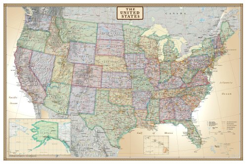
This 24×36 inch wall map by Swiftmaps offers a large, legible layout suitable for classrooms and offices. It is rolled (not folded) with double-sided, 3mil lamination, making the map durable and ready for dry-erase use. The laminated surface helps resist wear and tear from frequent marking and erasing, while the size makes it an excellent fit for medium to large wall spaces where quick geographic reference is needed.
24×36 United States Classic Wall Map Poster Mural Laminated
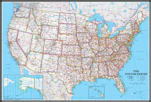
The Swiftmaps Classic Wall Map provides a current representation of the United States on a 24×36 inch surface. It includes up-to-date state boundaries and geographic detail suitable for education and planning. With a 3mil double-sided laminate, the map offers durability and a smooth dry-erase experience, enabling reuse across multiple lessons or planning sessions without significant wear.
Buying Guide
Key purchase considerations help buyers select the right large US road map for their needs:
- Size and visibility: Choose a map large enough to be read from the intended distance. Oversized formats work best for classrooms and big spaces, while 24×36 inch maps suit smaller walls.
- Durability and surface: Laminated surfaces resist wear and support dry-erase use. Double-sided lamination offers extra protection for high-traffic areas.
- Up-to-date data: Look for maps that reflect current political boundaries and major geographic features to ensure accuracy for teaching and planning.
- Format preferences: Poster or wall map formats vary in portability and installation. Poster maps can be rolled for storage, while large posters may be best for fixed displays.
- Intended use: Consider whether you need a general reference map, a travel-oriented atlas, or an interactive teaching tool with writable surfaces.
- Brand and quality: Reputable brands like National Geographic and Maps International tend to offer reliable cartography and durable production.
- Installation: Some maps come ready for framing or mounting; others are simply ready-to-hang posters. Check hardware requirements if mounting is necessary.
These selections offer a range of sizes, laminations, and formats designed to support learning, planning, and navigation in larger spaces. Each item prioritizes readability, durability, and up-to-date geographic detail to meet classroom, office, and home needs.